


Judas’ Ass (Cu de Judas in Portuguese) is an uninhabited mountainous area with a very peculiar name. Although this location has existed on the oldest maps of the Azorean archipelago, it has been forgotten and excluded from the most modern maps – but that all changed in 2021.
In 2021, Dott, a Portuguese e-commerce brand, created a marketing campaign that put Judas’ Ass in the “mouths of the world”. This campaign aimed to put this place back on the map through the petition “Help us put Judas’ Ass on the map!”.
Today, thanks to the petition signed by more than 6,000 Portuguese, Judas’ Ass is back on the map and even has a postcode! So, in this article, take the opportunity to learn about the history of this place and other points of tourist interest in the surrounding region.
What is Judas’ Ass?
Judas’ Ass is a mountainous site located near the Água Retorta Forest Park, in the parish of Água Retorta, between the municipalities of Povoação and Nordeste, on São Miguel Island, Azores. Despite being an area of vegetation, with no inhabitants and no apparent tourist attractions, Judas’ Ass has become a well-known point of interest on the island.

As a result of Dott’s campaign, thousands of curious people take the opportunity to visit this beautiful place full of picturesque landscapes and to photograph the iconic “Cu de Judas” sign. Nowadays, you can find Judas’ Ass on modern maps using the postcode 9650-007 in the Waze and Google Maps applications.
History: Origin of the Expression “Cu de Judas”

The expression “Cu de Judas” originated in Portuguese and means “distant place” or “end of the world”. In this sense, as this town is located in a remote and isolated area of the island, navigators began to call this slope by the name we know today — Judas’ Ass.

Plan Your Visit to Judas’ Ass
Best Time to Visit
Due to its location, São Miguel experiences mild temperatures year-round. However, in the winter months, periods of rain and lower temperatures become more frequent. In this sense, the best time to visit Judas’ Ass is usually between May and September, when the days are sunny and more inviting for nature walks. Keep in mind that this town is situated on a beautiful hillside.
However, it’s essential to note that cloudy skies are common across the archipelago’s islands, so it may be challenging to appreciate the true splendor of some viewpoints in this region at times.
Check all our articles about the weather in the Azores throughout the year 🌤️ ☔️: January | February | March | April | May | June | July | August | September | October | November | December
How to Get to Judas’ Ass
As mentioned above, Judas’ Ass is located in the parish of Água Retorta, near the municipalities of Povoação and Nordeste. In this sense, you can travel from either of these councils to your destination.
Leaving Povoação in the direction of Judas’ Ass, you should take the EN1-1A, where you will have to travel about 10 km. The journey takes approximately 14 minutes by car, 25 minutes by bus, 1 hour by bicycle, or 2 hours and 14 minutes on foot.
However, from the Nordeste towards Judas’ Ass, you will have to travel 16.5 km via the EN1-1A. The journey takes approximately:
- 25 minutes by car;
- 50 minutes by bus;
- 1 hour and 35 minutes by bicycle;
- 3 hours and 35 minutes on foot.
Planning a trip to the Azores? These articles will help you: How to Get to the Azores 🗺️ | Azores airports 🛬 | Flights between islands ✈️ | Ferries between islands ⛴️ | Which island to choose? 🏝️ | What airlines fly to the Azores? 🛩️
Where to Eat
If you need somewhere to eat near Judas’ Ass, click here. In this link, you’ll find the 10 best restaurants on TripAdvisor.
Where to Stay
To make your life easier, we’ve filtered the search by:
Azores Guide Book
Azorean Language & Phrases 🗣️ | Currency & Banks 💵 | Credit Cards & Traveler’s Cheques 🏧 | Driving in the Azores 🚗 | Electricity 🔌 | Experiences & Tours 🗺️ | Health & Safety 🩺 | Internet & Wi-Fi Access 🛜 | Phones & Mobile Service 📞 | Post Offices & Buying Stamps ✉️ | Public Holidays 🏖️ | Shopping 🛒 | Time & Daylight 🕒 | Whale Watching Guide 🐳 | Best Island to Visit 🏞️
Nearby Attractions
Farol do Arnel

The Farol do Arnel (Arnel Lighthouse), also known as the Ponta do Arnel Lighthouse, was built at the end of the 19th century by António Alves de Oliveira, the well-known “Northeast Worker”. It is now considered a heritage landmark in the municipality of Nordeste.
Over the years, the Arnel Lighthouse has undergone various improvements and adaptations, enabling it to remain up to date and capable of fulfilling its maritime signaling functions for all traffic sailing in Azorean waters. In addition to its essential functions, the lighthouse offers visitors a permanent exhibition on the lighthouses of the Azores — an excellent opportunity to learn about the island’s history and the lives of its lighthouse keepers.
→ Related article: Miradouro da Ponta do Arnel
Ponta do Sossego Viewpoint

The Ponta do Sossego Viewpoint, along with its neighboring Ponta da Madrugada, is very popular for watching the sunrise. Locals and travelers alike flock to the East Coast to witness this natural spectacle.
When the sun rises and fills the sky with incredible colors, it always wins us over! The sun burning like a considerable flame over the ocean in the early morning hours is an iconic sight that everyone should witness at least once. Some people sleep in their cars in the car park for this special event. Others drive at 5 a.m. to ensure they don’t miss the sunrise.
Faial da Terra

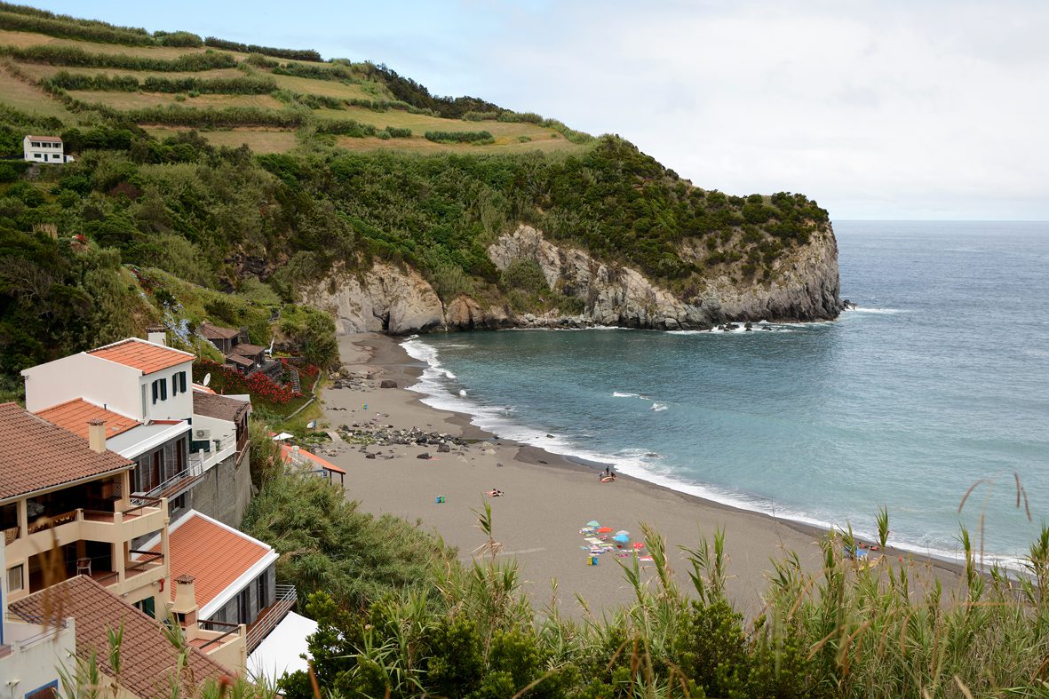
Faial da Terra, also known locally as “Presépio da Ilha,” is a parish in the municipality of Povoação on the island of São Miguel. It’s approximately 350 inhabitants who primarily live from farming. This parish has several distinct characteristics, including fertile land, proximity to the sea, and proximity to São Miguel‘s main bathing areas.
It is estimated that this was one of the first areas settled on the island at the beginning of the 16th century. During your visit to Faial da Terra, you can discover the wonderful Salto do Prego Trail, the unforgettable Aldeia do Sanguinho, and the imposing Salto do Prego Waterfall.

Agrião Hiking Trail

The Agrião Walking Trail is a linear route that begins at Porto da Ribeira Quente and leads to the mountains. It takes an average of 4 hours to complete. During the walk, you’ll be able to observe the various endemic species of the surrounding forest and contemplate the view over Tronqueira and Graminhais from the viewpoints you’ll find along the way. If you are eager to explore nature, this is an activity you can’t miss on your itinerary. The Agrião Trail offers plenty to see and appreciate, and is of medium difficulty, so be prepared for a good walk.
Check all our articles about each one of the most relevant points of interest in Nordeste: Cu de Judas | Nordeste | Farol do Arnel | Faial da Terra | Ponta do Sossego | Miradouro do Salto da Farinha | Pico da Vara | Pico dos Bodes | Poço Azul | Ribeira dos Caldeirões | Miradouro da Boca da Ribeira | Ponta da Madrugada | Miradouro Vigia da Baleia | Miradouro da Ponta do Arnel

Complementary Information
Best Season to Visit the Azores
The Azores Archipelago boasts a unique climate that shapes its lush landscapes, making it a splendid year-round destination. With mild temperatures and minimal fluctuations, each season offers something unique. Spring averages 16 °C, summer reaches 21 °C, autumn cools to 18 °C, and winter remains mild at 14 °C.
→ For a detailed breakdown of the weather by month, check the following links 🌤️☔️: January | February | March | April | May | June | July | August | September | October | November | December
How to Get to the Azores
The Azorean Archipelago is easily accessible through numerous flight routes. Lisbon and Porto are the main entry points to the continent, with direct flights available to São Miguel (PDL), Terceira (TER), Faial (HOR), Pico (PIX), and Santa Maria (SMA). To find the best flight, use search engines like eDreams or Skyscanner. These platforms let you compare prices and schedules from multiple airlines in one convenient location.
For more details on how to get to the Azores, take a look at our complete guide. But what if you want to explore beyond your arrival island? We’ve got you covered!
- Azores airports 🛬
- Flights between islands ✈️
- Ferries between islands ⛴️
- Which island to choose? 🏝️
- What airlines fly to the Azores? 🛩️
→ Once you’ve found the perfect route, book your tickets and get ready to experience one of the world’s most stunning island groups!
Travel Essentials
Essential Information for your Azores trip: Azorean Language & Phrases 🗣️ | Currency & Banks 💵 | Credit Cards & Traveler’s Cheques 🏧 | Driving in the Azores 🚗 | Electricity 🔌 | Experiences & Tours 🗺️ | Health & Safety 🩺 | Internet & Wi-Fi Access 🛜 | Phones & Mobile Service 📞 | Post Offices & Buying Stamps ✉️ | Public Holidays 🏖️ | Shopping 🛒 | Time & Daylight 🕒 | Whale Watching Guide 🐳 | Best Island to Visit 🏞️
Useful Tools & Apps
The weather in the Azores can be variable, so it’s helpful to use some apps before visiting the islands. Spotazores provides live camera feeds from the main tourist attractions, allowing you to check the weather and plan your visit. For accurate weather predictions, use Windy or Windguru — they provide the most reliable predictions.
Video
Conclusion
Judas’ Ass is a slight slope on the side of the Serra da Tronqueira. This isolated and uninhabited spot, far from the nearest urban areas, is an excellent place to enjoy the beauty of Azorean nature. When you visit the municipality of Povoação, take the opportunity to discover this and many other wonders that nature has to offer. You can also visit Nordeste and explore various tourist attractions, such as Farol do Arnel or Miradouro da Ponta do Sossego.
Authors’ Note
I am pleased to inform you that all the recommendations in this article are based on my personal experience and observations. As the author, I have personally visited each attraction mentioned, ensuring that every suggestion is grounded in first-hand knowledge and genuine enthusiasm.
FAQs
Judas’ Ass is a peak situated on São Miguel Island in the Azores, near the village of Água Retorta.
Judas’ Ass‘ main attraction is its panoramic view of the surrounding landscape, which makes it a popular spot for nature lovers.
Yes, there is a trail that starts from Água Retorta, passes by Pico Bartolomeu, and leads to Judas’ Ass. The trail is approximately 8.88 km long with a positive and negative elevation of 608 meters and is classified as an easy-level hike.
It’s recommended to hike to Judas’ Ass on dry, sunny days, wear proper walking footwear, and bring water and snacks. Always check the weather conditions before starting your hike.