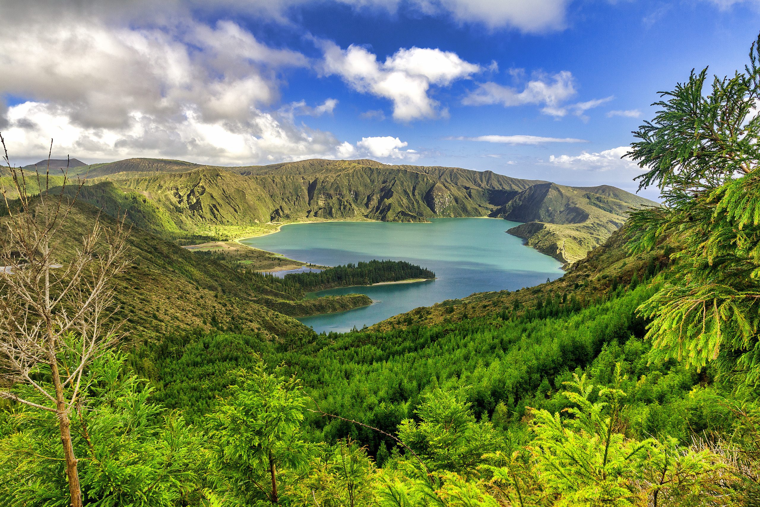


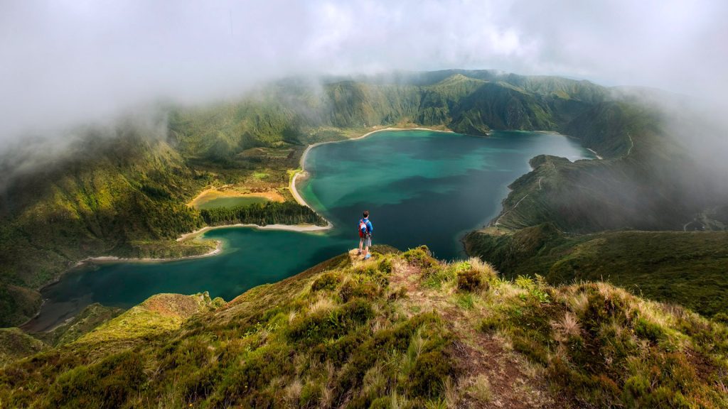
In the crater of a dormant volcano that formed about 15,000 years ago, Lagoa do Fogo offers breathtaking landscapes of exceptional natural beauty. From the central part of São Miguel island was born the Serra da Água de Pau Volcanic Massif, where Lagoa do Fogo is nested. It is of great value in terms of landscapes and untouched, pure nature.
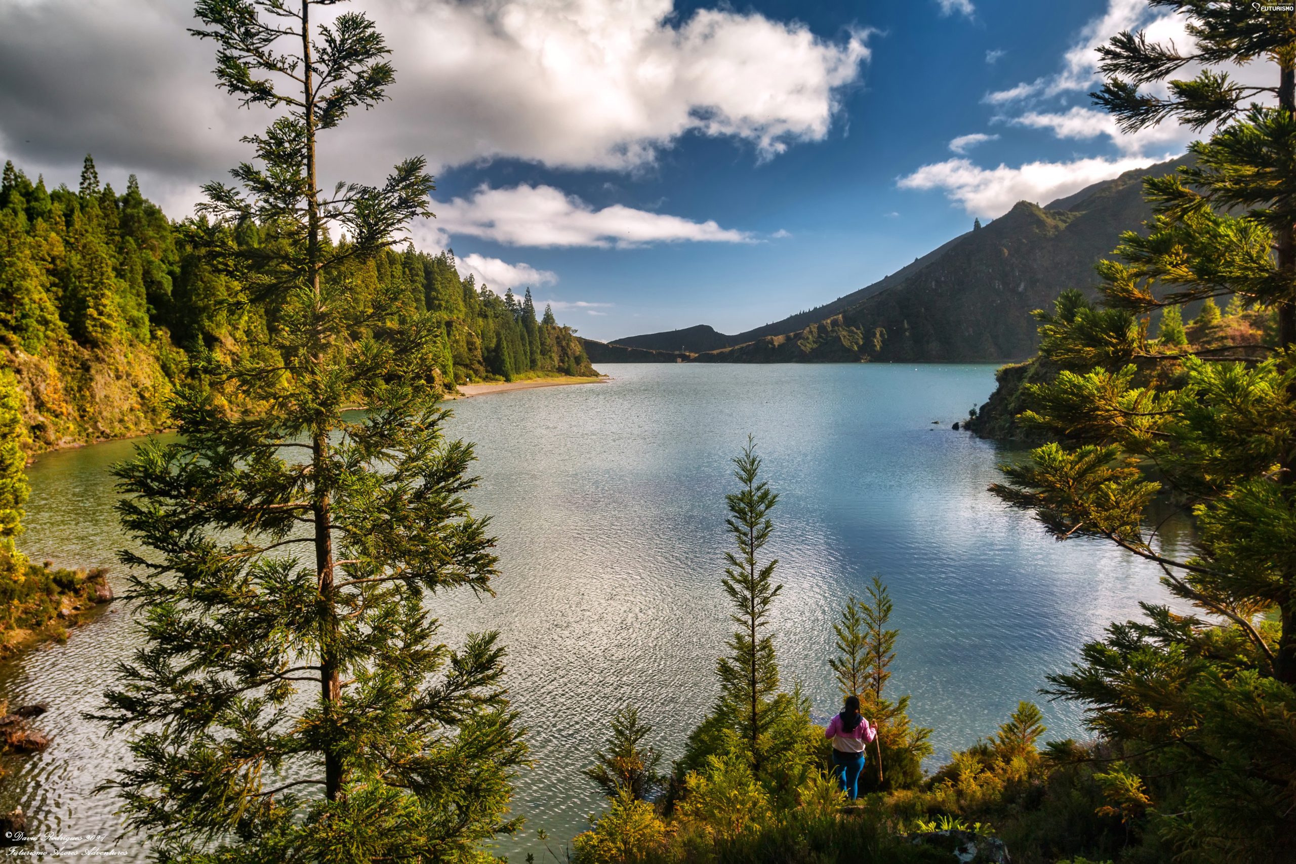
Located between Ribeira Grande and the city of Lagoa, this volcanic lake looks like a postcard from paradise. The green of the volcanic walls, filled with lush vegetation, contrasts with the clear blue water, undoubtedly making it one of the most beautiful places in the Azores. This is one of the main tourist highlights of São Miguel, but it still has some secrets inside that this post will unveil. Follow this complete guide to learn all you need to know about Lagoa do Fogo.
What is Lagoa do Fogo

Lagoa do Fogo is the second-largest lake in São Miguel, measuring 2 miles (3.22 km) in length and 1.5 miles (2.41 km) in width. It is also the highest on the island, with a 949m altitude for the highest point of the caldera and a 575m altitude for the lake. It has a total area of 1.360 hectares, and the lake is as deep as 30 meters. The volcanic crater is the youngest on São Miguel island, having formed around 15,000 years ago. Its current configuration results from the last collapse around 5,000 years ago and the last eruption in 1563.
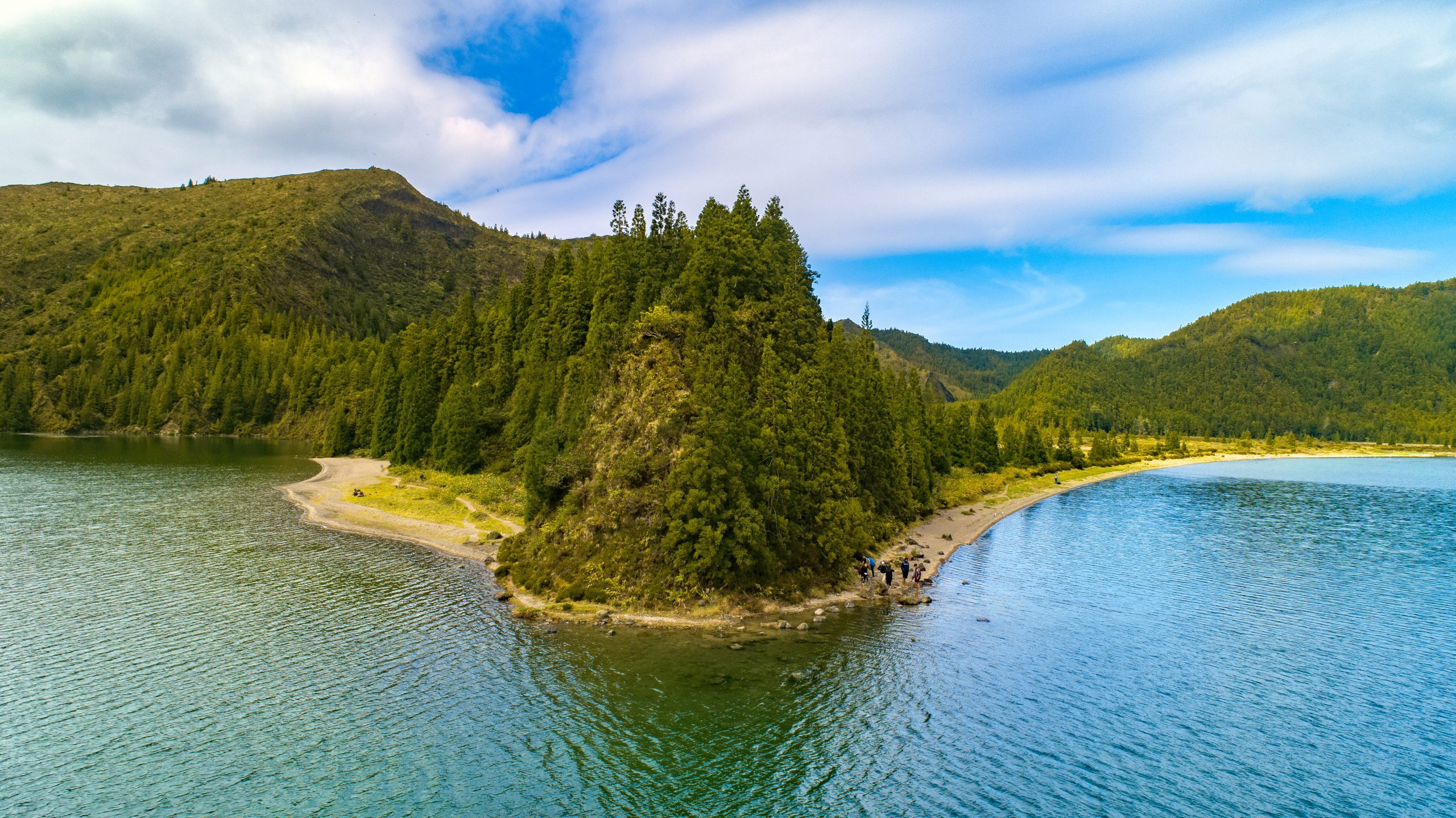
With two green peninsulas entering the lake and excellent pristine waters, Lagoa do Fogo officially became a nature reserve in 1974. The European Commission approved it as a special area for conservation in 2001, making it part of the Natura 2000 network.
The crater’s green walls, reminding one of Hawaii, reach 300 meters high. Lagoa do Fogo is surrounded by luxuriant endemic flora and crystal-clear waters, offering a singular beauty. Between the vegetation, you can find the Azores Juniper, Laurel, Heather, and Frangula azorica. Among the fauna, you can mostly see birds of all sizes. If you look up, you will find Azores wood pigeons, kites, buzzards, gray wagtails, and seagulls and terns.
What to Do at Lagoa do Fogo
Lagoa do Fogo Hiking Trails
There are different routes to hike in Lagoa do Fogo, but we will develop two main options: the hike down the lake and the hike from the South Coast. You can also walk around the crater for a bit, offering different views of the lake. If you pay close attention, you can even spot Ilhéu de Vila Franca and Santa Maria Island. There is also a trail from Lagoa do Fogo to Lombadas, which is one of the island’s most untouched parts.
Descent to Lagoa do Fogo

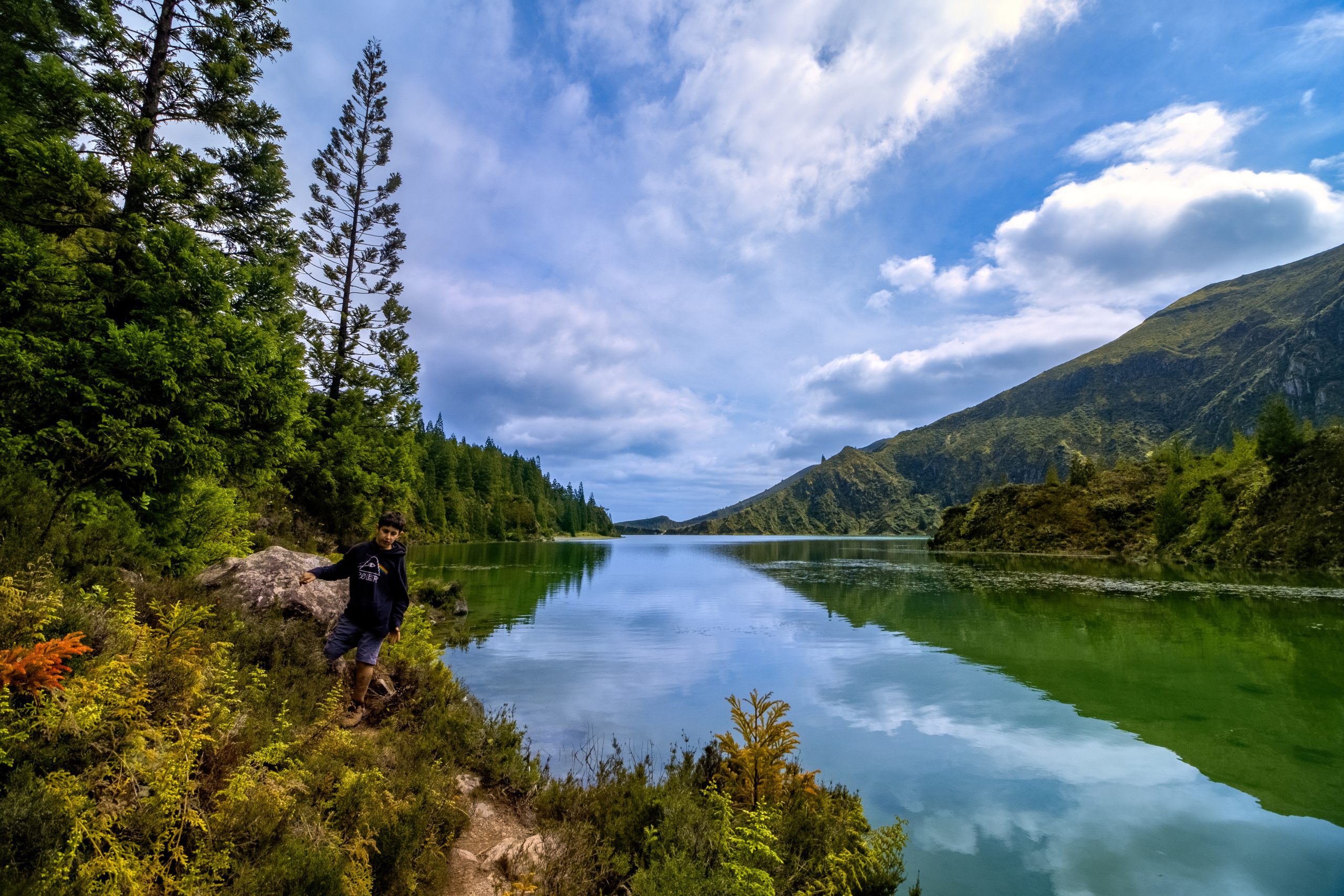
This is the shorter and easier option. It takes about 20 minutes to walk down to the lake shore from the viewpoint of Lagoa do Fogo. Please note that this is not an official trail, but many people use it every day, so the path is obvious. Furthermore, try to walk on the path so as not to destroy the surrounding vegetation.
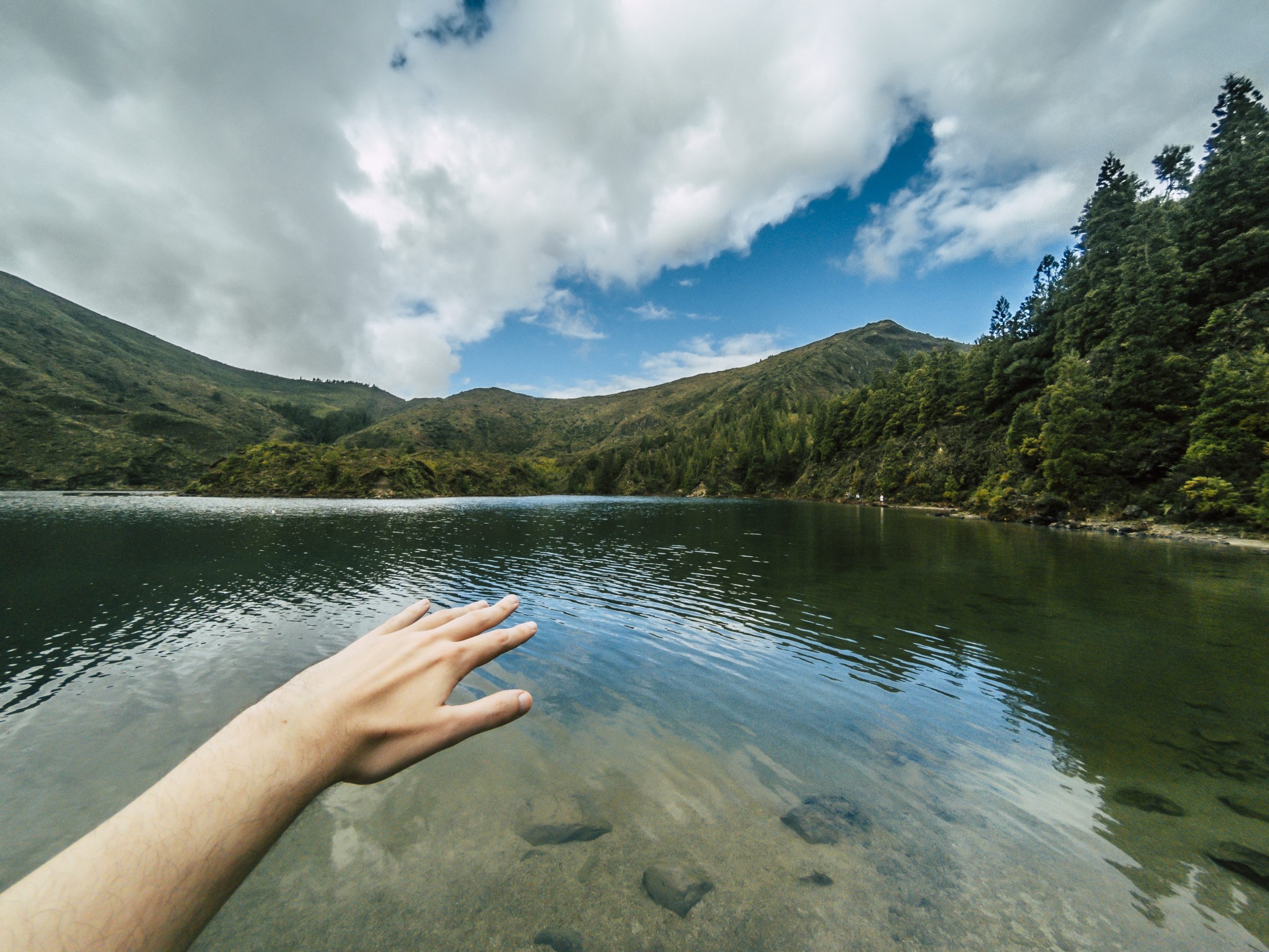
On rainy days, the trail can be muddy, so be careful and wear good hiking shoes. Note that the trail is quite steep. You will begin to go down, which can be slippery, and then up, which can be a bit tiring. Don’t stop right at the lake shore; you can continue to the beach and even discover another smaller lake inside the crater! It will take around one hour to go down to the lake beach and back up the same way.
If the water levels are low, it is easy to explore a bit more around the lake. You can even circle the whole lake if you don’t mind having wet feet and have plenty of time. You will see different beaches, views of the lakes, some caves, and dense vegetation.
Lagoa do Fogo from Água d’Alto Beach
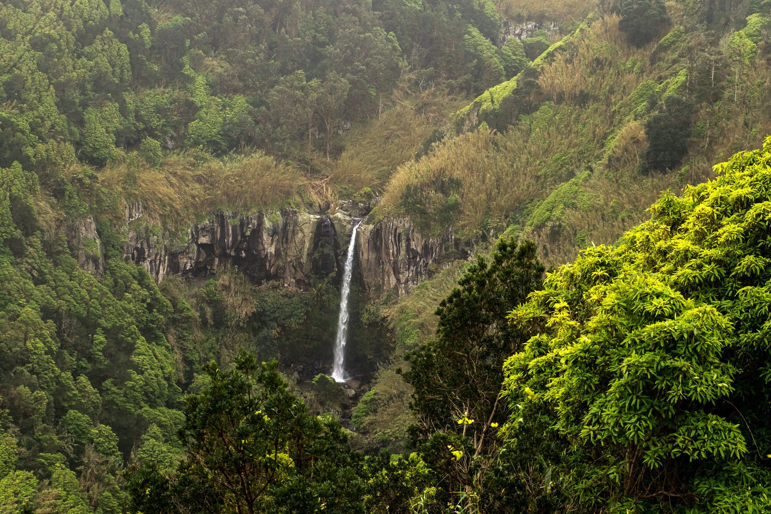
The longer and more complicated way to get to the Lagoa do Fogo, but also the most beautiful, is to begin at Água d’Alto beach, near Pestana Bahia Hotel. From there, follow the marks indicating Quatro Fábricas da Luz. This relatively short trail features the ruins of an old geothermal factory that once provided energy to many locals. Moreover, you will pass by the beautiful waterfall Cascata do Segredo and a pond where you can go swimming.
An easier way is to begin at Praia, where the trail Quatro Fábricas da Luz ends. This way, you save about 1 hour of ascent and 2 hours for the round trip. From Praia, the circular trail that goes to Lagoa do Fogo and back to the starting point takes about 4 hours in total.
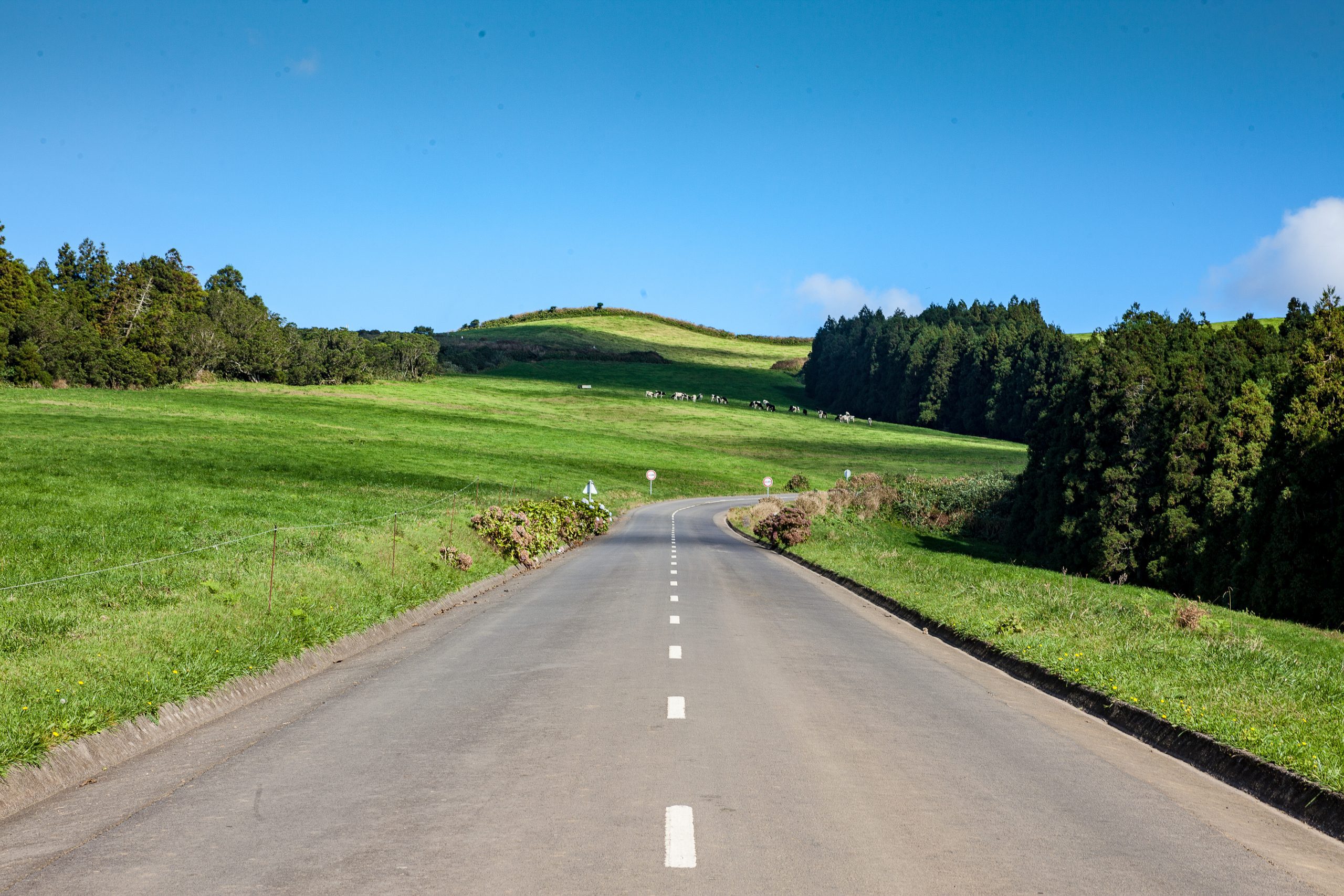
The starting point of Praia is on a secondary road surrounded by farming lands. It takes about 30 minutes to drive from Ponta Delgada. The trail takes you to the other side of Lagoa do Fogo, which is not accessible by road. It may be a long way and go up for a while, but it gives a beautiful view that not many people will see. Furthermore, there is a great diversity of landscapes, from farmland to forest, including a view of Ilhéu de Vila Franca.
Admire the View at the Lagoa do Fogo Viewpoint
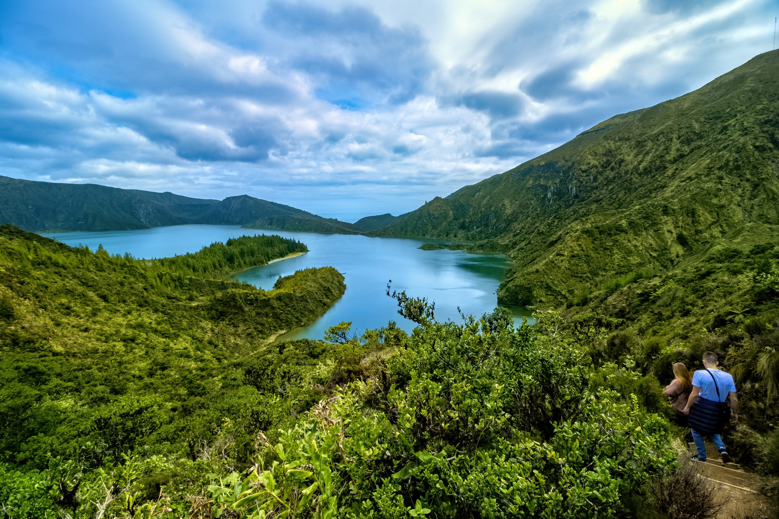
Along the way up to the Lagoa do Fogo viewpoints, there are different places to stop the car and observe the magnificence of nature from various angles. Viewpoints are the best way to get the most beautiful pictures of Lagoa do Fogo. The two main views are:
- Miradouro da Barrosa: the first one when you come from Ponta Delgada. From there, it is possible to see both the North and South coasts of São Miguel island and, of course, the lake.
- Lagoa do Fogo Viewpoint: where the descent hike begins. From there, you have a more expansive view of the lake.
As the first viewpoint is higher, it can be more cloudy than the other one.
→ Related articles: Água d’Alto Beach | Ponta Delgada | Vila Franca do Campo Islet | Ribeira Grande | Lagoa | Pico da Barrosa
Can I swim in the lake?
The short answer is no. This is a nature reserve, and for preservation purposes, it is forbidden to swim in its tempting waters. Note that from the weather camera, you can see the lake, so it is possible that when you go back up, someone will be expecting you, and you will receive a fine. Cameras, you can have a fine when you come back up.
Did you know
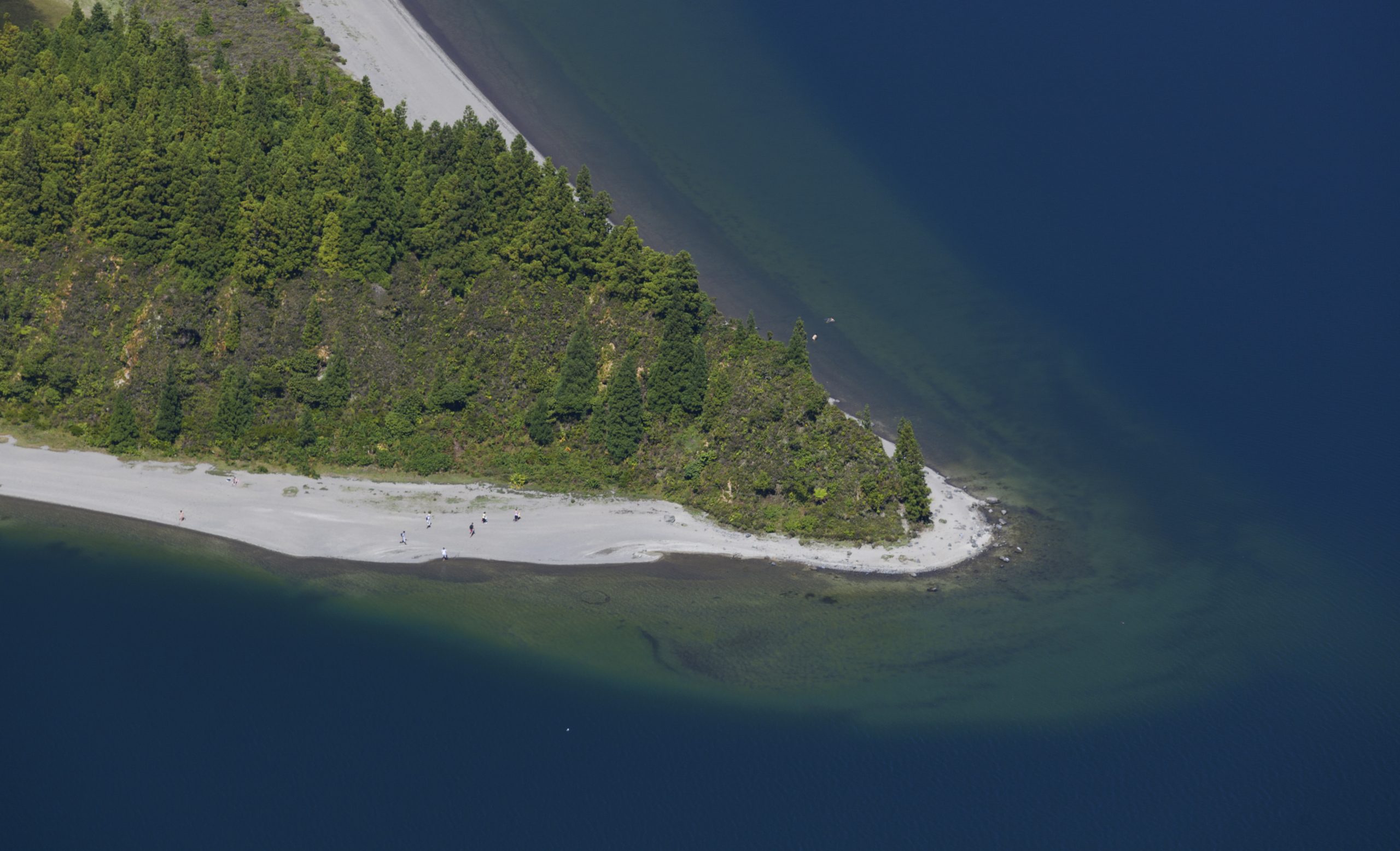
Was the beach of Lagoa do Fogo elected as one of Portugal’s Seven Wonders in the category of Wild Beaches in 2012? Even though swimming is not allowed, you can still go down to the pumice beach to work on your tan.
Best Time to Visit Lagoa do Fogo

From dawn to the last hours of the day, Lagoa do Fogo is always beautiful, even at night! Moreover, from January to December, it is always possible to explore this part of the island. Let’s see together the best time to visit this wonder of nature.
Best Season of the Year
The summer is when you will have more chances of a clear view. However, it is also that time of the year when there are more travelers on the island so that the spot can get crowded. July and August are the busiest months, but June and September still have decent yet unpredictable weather conditions, similar to the rest of the year. As Lagoa do Fogo is at an altitude, it can get a bit cold and windy in the wintertime. There can even be hail on rare occasions. Furthermore, there might be more clouds, and the view of the lake will likely be blocked.
Check all our articles about the weather in the Azores throughout the year 🌤️ ☔️: January | February | March | April | May | June | July | August | September | October | November | December
Best Time of the Day
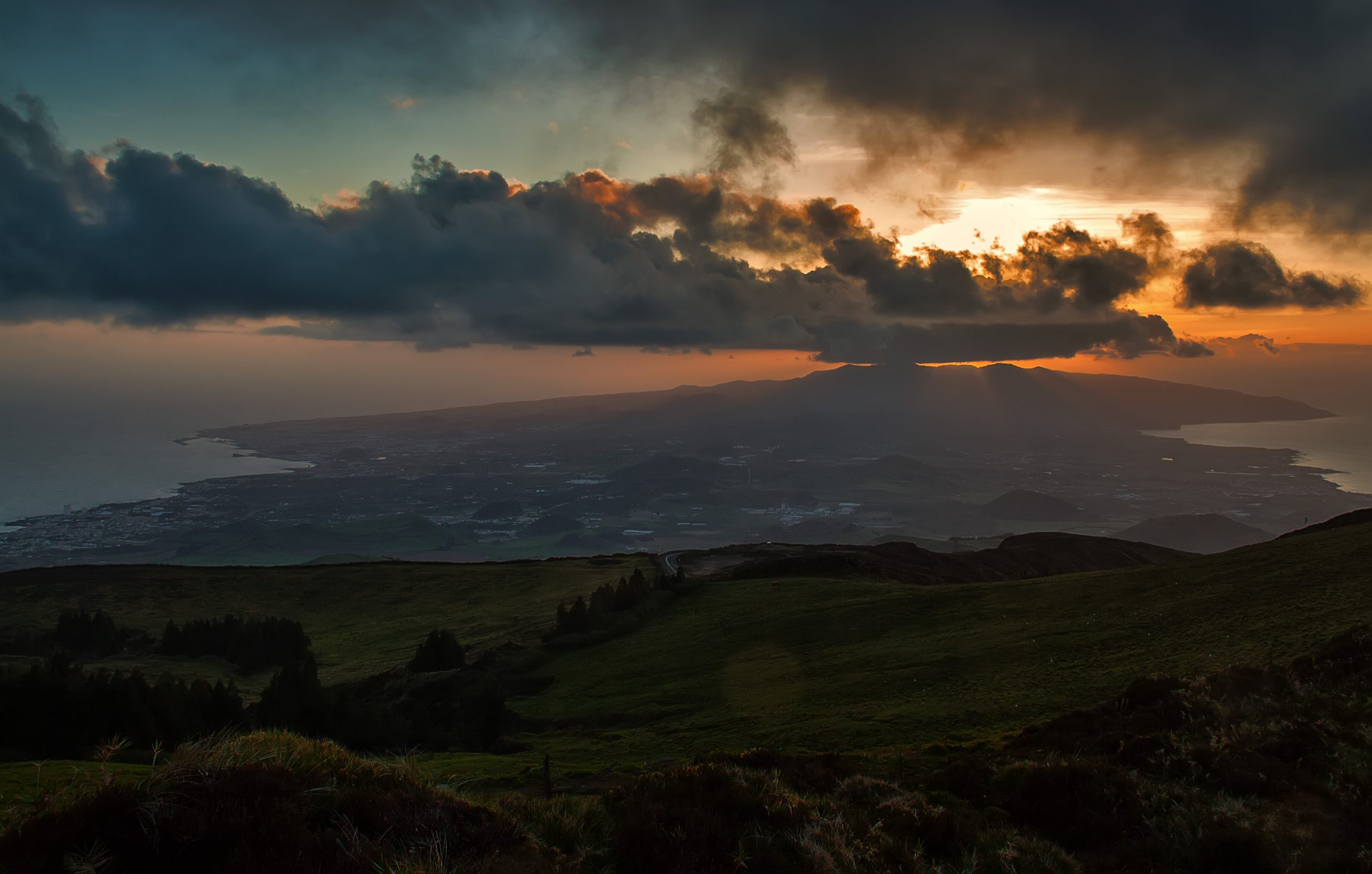
If you are visiting during the summer, your best bet is to go early in the morning or late in the afternoon alone or with a few visitors. Sunrises and sunsets are incredible to watch from the top of Lagoa do Fogo.
Furthermore, an exceptional time to go is at night. Why, you might think. Well, as you are at an altitude and there are no lights around, Lagoa do Fogo is a perfect spot for stargazing. You can even see the Milky Way! In the summer, don’t miss the shooting star nights.
Plan Your Visit to Lagoa do Fogo
How to Get to Lagoa do Fogo
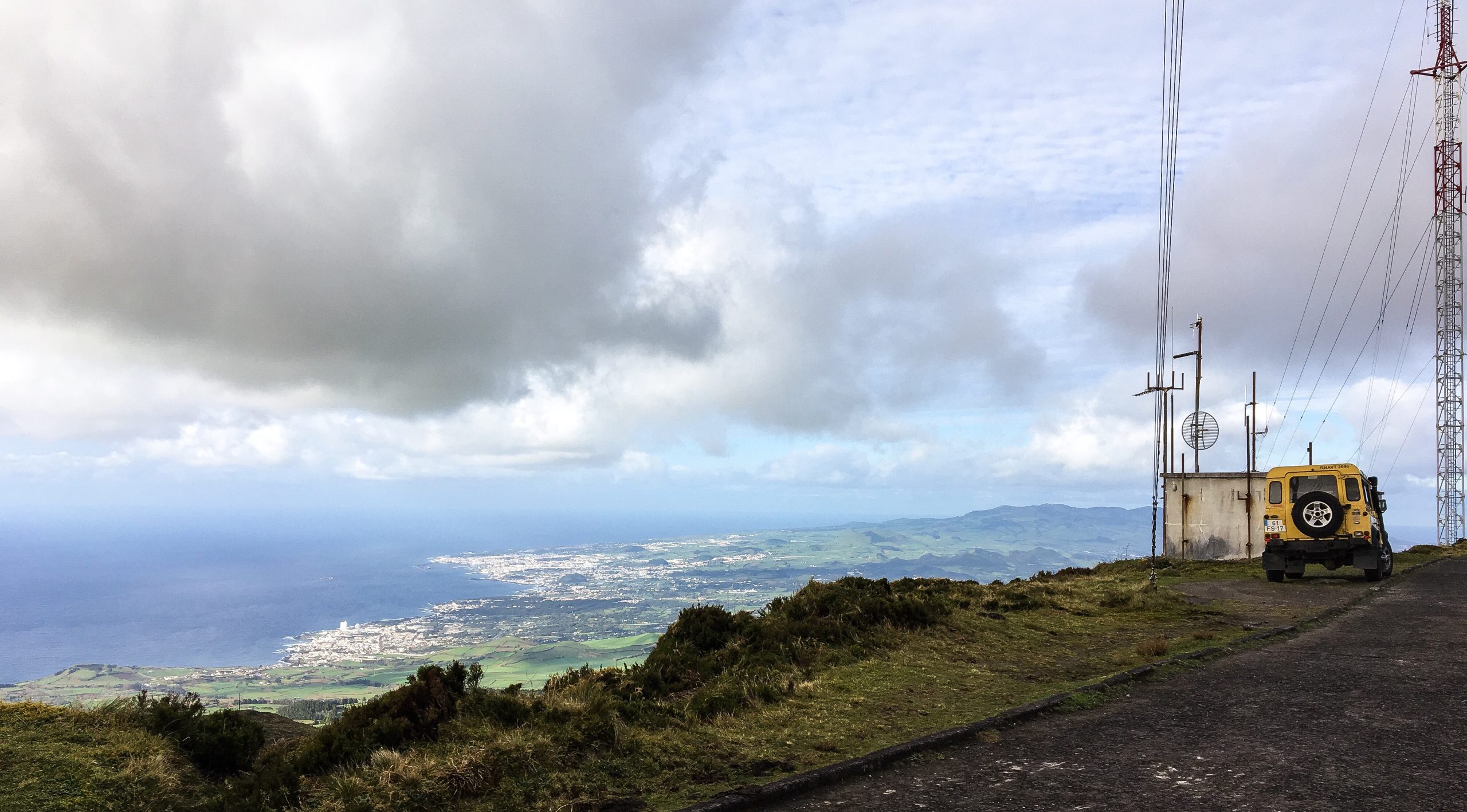
Lagoa do Fogo is located in Pico da Barrosa, accessible by the EN5-2A road. There is no public transportation going to Lagoa do Fogo, so the only ways to go are by car, taxi, or guided tour.
At Futurismo, we offer various experiences that pass by Lagoa do Fogo, including hiking tours, van tours, and jeep tours. Our experienced guides know everything about this unbelievable region of the island.
You can also opt for the hike from Água d’Alto to be closer to nature, but it is the more challenging and more extended option.
Planning a trip to the Azores? These articles will help you: How to Get to the Azores 🗺️ | Azores airports 🛬 | Flights between islands ✈️ | Ferries between islands ⛴️ | Which island to choose? 🏝️ | What airlines fly to the Azores? 🛩️
Pro Tips
Be careful when putting Lagoa do Fogo in your GPS; it can lead you to the south of the island, and then you have to do the 2-hour hike. In reality, it is just a short walk from the viewpoint to see the lake. Furthermore, going down to the lake shore is worth it. Don’t just stop at the viewpoint unless you don’t have time. The hike down offers incredible views and serves as a good exercise, surrounded by beautiful nature.

Complementary Information
Best Season to Visit the Azores
The Azores Archipelago boasts a unique climate that shapes its lush landscapes, making it a splendid year-round destination. With mild temperatures and minimal fluctuations, each season offers something unique. Spring averages 16 °C, summer reaches 21 °C, autumn cools to 18 °C, and winter remains mild at 14 °C.
→ For a detailed breakdown of the weather by month, check the following links 🌤️☔️: January | February | March | April | May | June | July | August | September | October | November | December
How to Get to the Azores
The Azorean Archipelago is easily accessible through numerous flight routes. Lisbon and Porto are the main entry points to the continent, with direct flights available to São Miguel (PDL), Terceira (TER), Faial (HOR), Pico (PIX), and Santa Maria (SMA). To find the best flight, use search engines like eDreams or Skyscanner. These platforms let you compare prices and schedules from multiple airlines in one convenient location.
For more details on how to get to the Azores, take a look at our complete guide. But what if you want to explore beyond your arrival island? We’ve got you covered!
- Azores airports 🛬
- Flights between islands ✈️
- Ferries between islands ⛴️
- Which island to choose? 🏝️
- What airlines fly to the Azores? 🛩️
→ Once you’ve found the perfect route, book your tickets and get ready to experience one of the world’s most stunning island groups!
Travel Essentials
Essential Information for your Azores trip: Azorean Language & Phrases 🗣️ | Currency & Banks 💵 | Credit Cards & Traveler’s Cheques 🏧 | Driving in the Azores 🚗 | Electricity 🔌 | Experiences & Tours 🗺️ | Health & Safety 🩺 | Internet & Wi-Fi Access 🛜 | Phones & Mobile Service 📞 | Post Offices & Buying Stamps ✉️ | Public Holidays 🏖️ | Shopping 🛒 | Time & Daylight 🕒 | Whale Watching Guide 🐳 | Best Island to Visit 🏞️
Useful Tools & Apps
The weather in the Azores can be variable, so it’s helpful to use some apps before visiting the islands. Spotazores provides live camera feeds from the main tourist attractions, allowing you to check the weather and plan your visit. For accurate weather predictions, use Windy or Windguru — they provide the most reliable predictions.
Video
Conclusion
As you might have understood from this post, Lagoa do Fogo is a wonderful place to spend a unique day in the Azores. You should not miss this wonder of nature when on holiday on São Miguel Island.
Join Futurismo on a guided tour for a complete experience of Lagoa do Fogo by foot, van, or jeep — you decide your adventure!
Authors’ Note
I am pleased to inform you that all the recommendations in this article are based on my personal experience and observations. As the author, I have personally visited each attraction mentioned, ensuring that every suggestion is grounded in first-hand knowledge and genuine enthusiasm.
FAQs
Lagoa do Fogo is a volcanic lake on the island of São Miguel, Azores. Located in the caldera of the Água de Pau volcano, it is renowned for its natural beauty, with crystal-clear waters and lush vegetation.
At Lagoa do Fogo, you can enjoy hiking, bird watching, nature photography, and picnicking. Swimming and other water activities are limited to protect the ecosystem.
Lagoa do Fogo is a 30-minute drive from Ponta Delgada, São Miguel’s central city. Well-marked roads lead to the main viewpoint. For adventurers, there are hiking trails from various island locations that lead to the lake.
Camping is not allowed at Lagoa do Fogo to protect the environment and preserve local flora and fauna. There are camping areas elsewhere on the island of São Miguel where you can enjoy nature.
Gallery