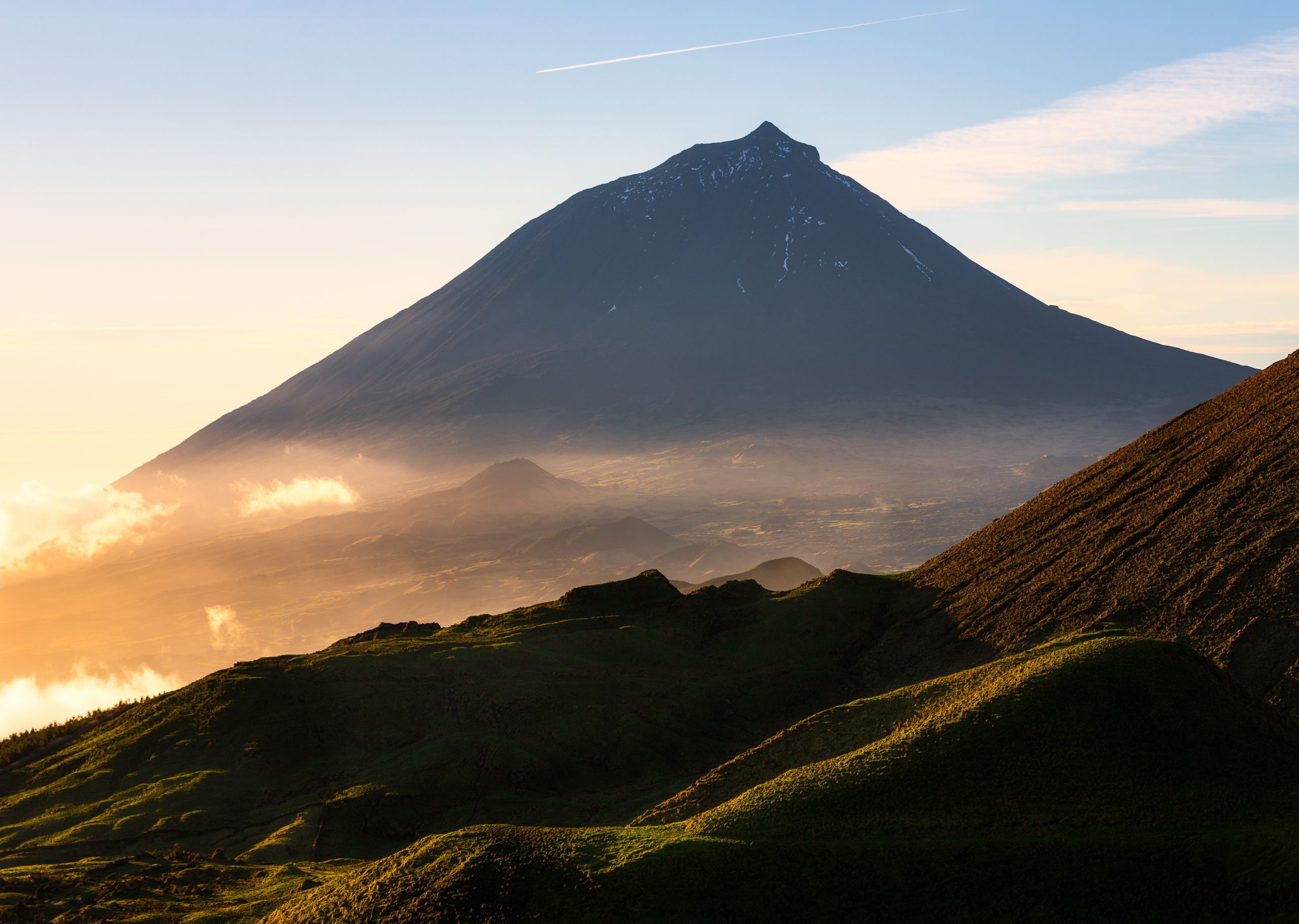

Pico Alto, wörtlich übersetzt der Hohe Gipfel, ist der höchste Punkt von Santa Maria, einer der 9 Inseln der Azoren. Er liegt 587 Meter über dem Meeresspiegel, also 1.925 Fuß. Von dort oben hat man einen der besten Ausblicke auf die Insel Santa Maria mit ihren grünen Weiden, der Vegetation, einigen malerischen Dörfern, der Küste und dem unendlichen Atlantik.
Entdecken Sie mehr über diesen schönen Ort. Wie man dorthin kommt, was man tun kann und weitere historische Fakten über diesen Ort, den Sie während Ihres Urlaubs auf der Gelben Insel unbedingt besuchen sollten.
Was ist Pico Alto?

Der Pico Alto ist der höchste Berg auf Santa Maria, der Insel der Sonne. Er ist das Ergebnis einer Phase intensiven Vulkanismus, die durch unterseeische Eruptionen vor etwa 5 Millionen Jahren ausgelöst wurde. Dieser einzigartige Gipfel der Insel fängt die Wolken ein und schafft ein feuchtes Gebiet mit üppiger Vegetation.
In diesem Gebiet findet man einheimische Pflanzen, die von den Behörden wieder eingeführt wurden, wie die Azoren-Heide (Vaccinium cylindraceum) und den Azoren-Lorbeer (Laurus azorica). Was die Fauna betrifft, so können Sie in der Umgebung zahlreiche Vögel beobachten. Beobachten Sie den berühmten und kleinen Regulus regulus sanctaemariae, eine endemische Unterart, die nur in Santa Maria vorkommt. Es gibt einige einzigartige Arthropoden wie Athous pomboi, Donus multifidus, Tarphius pomboi oder Tarphius serranoi.
Wussten Sie schon
Am Pico Alto sind bereits drei verschiedene Flugzeuge abgestürzt: eine Douglas C-54 im Jahr 1945, eine Piper Aztec im Jahr 1964 und eine Boeing 707-300 im Jahr 1989. Auf dem Weg um den Gipfel befindet sich ein Denkmal zu Ehren der 144 Passagiere, die bei dem Vorfall ums Leben kamen.
Planen Sie Ihren Besuch in Pico Alto

Wie man nach Pico Alto kommt
Pico Alto befindet sich in der Gemeinde Santa Bárbara auf der Insel Santa Maria. Von Vila do Porto, dem Hauptort der Insel Santa Maria, nehmen Sie einen Mietwagen oder ein Taxi und folgen der Hauptstraße (EN1-2A) in Richtung Osten, bis Sie das Dorf Almagreira durchqueren. Wenn Sie aus dem Dorf herauskommen, nehmen Sie die Nebenstraße links bis zum Parkplatz. Insgesamt benötigen Sie mit dem Auto etwa 17 Minuten für die 10 km von Vila do Porto.
Rund um den Pico Alto bietet der Wanderweg PRC02 SMA eine Möglichkeit, die Gegend zu Fuß zu erkunden. Es handelt sich um eine 6,2 km lange Schleife mit mittlerem Schwierigkeitsgrad und einer Gehzeit von etwa 2 Stunden. Eine weitere gute Möglichkeit, den Pico Alto zu erkunden.
Planen Sie eine Reise auf die Azoren? Diese Artikel werden Ihnen helfen: Wie man auf die Azoren kommt 🗺️ | Flughäfen auf den Azoren 🛬 | Flüge zwischen den Inseln ✈️ | Fähren zwischen den Inseln ⛴️ | Welche Insel soll ich wählen? 🏝️ | Welche Fluggesellschaften fliegen die Azoren an? 🛩️
Beste Zeit für einen Besuch
Die beste Zeit für einen Besuch des Pico Alto in Santa Maria hängt davon ab, wie Sie ihn erreichen wollen. Wenn Sie mit dem Auto fahren, ist der Weg zum Gipfel recht kurz, so dass Sie so ziemlich zu jeder Tageszeit gehen können. Wenn Sie jedoch eine Wanderung planen, sollten Sie morgens oder am frühen Nachmittag losgehen, um Ihre Zeit gut einteilen zu können. Starten Sie am besten morgens, um die Mittagshitze zu vermeiden, und beenden Sie die Wanderung aus Sicherheitsgründen vor Sonnenuntergang.
Sehen Sie sich alle unsere Artikel über das Wetter auf den Azoren im Laufe des Jahres an 🌤️ ☔️: Januar | Februar | März | April | Mai | Juni | Juli | August | September | Oktober | November | Dez.Glut
Profi-Tipps

Wanderer sollten je nach Wetterlage Wasser, Snacks, eine Regenjacke, einen Hut und Sonnenschutzmittel mitnehmen. Obwohl es sich nicht um einen schwierigen Weg handelt, sollten Sie geeignete Wanderschuhe und mehrere Kleidungsschichten tragen.
Auch die Kasematten des Pico Alto sollten Sie sich nicht entgehen lassen, denn sie verleihen Ihrem Besuch auf dem höchsten Gipfel der Insel einen historischen Touch. Die portugiesische Luftwaffe baute diese Anlagen 1956 während des Kalten Krieges im Gefolge des Warschauer Paktes. Der Standort wurde speziell für eine neue Radarstation konzipiert. Auch wenn sie heute nicht mehr voll funktionsfähig ist, dient sie als Sendeanlage.
Azoren Reiseführer
Azoreanische Sprache & Redewendungen 🗣️ | Währung & Banken 💵 | Kreditkarten und Reiseschecks 🏧 | Autofahren auf den Azoren 🚗 | Elektrizität 🔌 | Erlebnisse & Touren 🗺️ | Gesundheit und Sicherheit 🩺 | Internet & Wi-Fi Zugang 🛜 | Telefone und mobiler Service 📞 | Postämter & Briefmarkenkauf ✉️ | Feiertage 🏖️ | Einkaufen 🛒 | Zeit & Sommerzeit 🕒 | Walbeobachtungsführer 🐳 | Beste Insel zum Besuchen 🏞️
Attraktionen in der Nähe
Praia de São Lourenço

Der Praia de São Lourenço an der Nordostküste von Santa Maria ist eine der Hauptattraktionen der Insel. Er wurde durch einen halbkreisförmigen Vulkankrater geformt, der heute eine malerische Bucht bildet. Umgeben von traditionellen, terrassenförmig angelegten Weinbergen aus Basaltgestein, ist dieser Strand ein wahres Schmuckstück.
Dies ist einer der wenigen Strände mit hellem Sand auf den Azoren. Mit seinem kristallklaren, meist ruhigen Wasser ist er ideal zum Schwimmen, Schnorcheln und Entspannen. Es gibt auch einen natürlichen Pool, einen ruhigen und malerischen Ort zum Baden, ideal für Kinder.
Der Praia de São Lourenço bietet eine hervorragende Infrastruktur für alle Besucher. Der Strandbereich bietet Toiletten, Duschen, Parkplätze und sogar eine Bar vor Ort. Der Miradouro de São Lourenço garantiert einen postkartenwürdigen Panoramablick, den Sie nicht verpassen sollten.
→ Verwandter Beitrag: Die besten Strände auf den Azoren. Mehr lesen!
Barreiro da Faneca

Barreiro da Faneca, auf der Nordseite von Santa Maria, ist ein einzigartiges geologisches Phänomen. Die Einheimischen nennen dieses Schutzgebiet oft die ‘Rote Wüste der Azoren". Der trockene, lehmhaltige Boden mit seinen intensiven Rot- und Orangetönen prägt den Charakter der Landschaft. Die Landschaft ist gewellt und wirkt wie ein völlig anderer Planet.
Je nach Tages- und Jahreszeit kann man hier die Wüste fast für sich allein genießen, denn viele Menschen fahren nach Santa Maria, um Zeit am Strand zu verbringen. Außerdem ist das Gebiet recht klein, so dass es nicht viel zu tun gibt, wenn man die roten Hügel genossen und viele Fotos gemacht hat.
Barreiro da Faneca ist leicht mit dem Auto zu erreichen, da eine Straße dorthin führt. Alternativ können Besucher Wanderwege wie den Wanderweg Costa Norte (PR01SMA) oder Teile des Fernwanderwegs der Insel (GR01SMA) erkunden, die durch die rote Tonlandschaft führen.
Vila do Porto

Vila do Porto ist die Hauptstadt der Insel Santa Maria und liegt in der gleichnamigen Pfarrei und Gemeinde. Vila do Porto wurde 1432 von Gonçalo Velho Cabral gegründet und war die erste Stadt auf dem Azoren-Archipel. Die Gemeinde Vila do Porto wurde jedoch erst 1470 von Siedlern gegründet. Fünf Kirchengemeinden: Almagreira, Santa Bárbara, Santo Espírito, São Pedro und Vila do Porto - unterteilen die Gemeinde.
Wenn Sie also auf der Durchreise sind, sollten Sie unbedingt die Hauptattraktionen von Vila do Porto besuchen, wie z. B.:
- Miradouro de São Lourenço;
- Pico Alto;
- Leuchtturm Gonçalo Velho;
- Baía da Raposo;
- Figueiral-Höhle;
- Baía dos Anjos;
- Unter anderem.
PPlanen Sie eine Reise auf die Azoren? ✨ Lesen Sie unseren vollständigen Leitfaden zu Gesetzliche Feiertage auf den Azoren: Vollständige Liste & Reiseführer
Praia Formosa

Praia Formosa liegt an der Südküste von Santa Maria. Er ist berühmt für einen der wenigen Strände der Azoren mit klarem Sand, der sich über eine Länge von etwa einem Kilometer erstreckt.
Das Wasser in Praia Formosa ist außergewöhnlich klar, warm und seicht und damit ideal zum Schwimmen und Schnorcheln. Die Wassertemperatur ist das ganze Jahr über zum Baden geeignet. Vom Miradouro da Macela aus können Sie das Panorama des Strandes, der Bucht und der Küste genießen.
Seine Wasserqualität und seine Einrichtungen werden jedes Jahr mit der Blauen Flagge ausgezeichnet. Der Strand bietet eine hervorragende Ausstattung für alle Besucher, darunter Parkplätze, Duschen und Toiletten. Ein Restaurant, saisonale Rettungsschwimmer und ein barrierefreier Zugang für Menschen mit Mobilitätsproblemen runden das Angebot ab. An einem Ende des Strandes befindet sich auch ein Campingplatz, der preisgünstige Unterkünfte mit direktem Zugang zum Strand bietet.
Praia Formosa liegt etwa 10 Autominuten von Vila do Porto entfernt und ist leicht zu erreichen. Unter August, In Praia Formosa findet das Festival Maré de Agosto statt. Die Veranstaltung findet seit 1984 jährlich statt und zieht viele Menschen aus Santa Maria und von anderen Inseln an.
Lesen Sie alle unsere Artikel über die wichtigsten Sehenswürdigkeiten auf Santa Maria Island: Praia Formosa | Barreiro da Faneca | Kaskade von Aveiro | Miradouro Vigia da Baleia | Pico Alto
Ergänzende Informationen
Beste Jahreszeit für einen Besuch der Azoren
Der Azoren-Archipel verfügt über ein einzigartiges Klima, das seine üppigen Landschaften prägt und es zu einem ganzjährig attraktiven Reiseziel macht. Mit milden Temperaturen und minimalen Schwankungen bietet jede Jahreszeit etwas Einzigartiges. Der Frühling hat im Durchschnitt 16 °C, der Sommer erreicht 21 °C, der Herbst kühlt auf 18 °C ab und der Winter bleibt mit 14 °C mild.
→ Eine detaillierte Aufschlüsselung des Wetters nach Monaten finden Sie unter den folgenden Links 🌤️☔️: Januar | Februar | März | April | Mai | Juni | Juli | August | September | Oktober | November | Dez.Glut
Wie man auf die Azoren kommt
Die Inselgruppe der Azoren ist über zahlreiche Flugrouten leicht zu erreichen. Lissabon und Porto sind die wichtigsten Zugangspunkte zum Kontinent, mit Direktflügen nach São Miguel (PDL), Terceira (TER), Faial (HOR), Pico (PIX), und Santa Maria (SMA). Um den besten Flug zu finden, verwenden Sie Suchmaschinen wie eDreams oder Skyscanner. Auf diesen Plattformen können Sie die Preise und Flugpläne mehrerer Fluggesellschaften bequem an einem Ort vergleichen.
Weitere Informationen über die Anreise zu den Azoren finden Sie in unserem kompletter Leitfaden. Aber was ist, wenn Sie über Ihre Ankunftsinsel hinausgehen wollen? Wir haben das Richtige für Sie!
- Flughäfen auf den Azoren 🛬
- Flüge zwischen den Inseln ✈️
- Fähren zwischen den Inseln ⛴️
- Welche Insel soll ich wählen? 🏝️
- Welche Fluggesellschaften fliegen die Azoren an? 🛩️
→ Wenn Sie die perfekte Route gefunden haben, buchen Sie Ihre Tickets und machen Sie sich bereit, eine der atemberaubendsten Inselgruppen der Welt zu erleben!
Reise-Essentials
Wichtige Informationen für Ihre Azorenreise: Azoreanische Sprache & Redewendungen 🗣️ | Währung & Banken 💵 | Kreditkarten und Reiseschecks 🏧 | Autofahren auf den Azoren 🚗 | Elektrizität 🔌 | Erlebnisse & Touren 🗺️ | Gesundheit und Sicherheit 🩺 | Internet & Wi-Fi Zugang 🛜 | Telefone und mobiler Service 📞 | Postämter & Briefmarkenkauf ✉️ | Feiertage 🏖️ | Einkaufen 🛒 | Zeit & Sommerzeit 🕒 | Walbeobachtungsführer 🐳 | Beste Insel zum Besuchen 🏞️
Nützliche Tools & Apps
Das Wetter auf den Azoren kann sehr wechselhaft sein, daher ist es hilfreich, vor dem Besuch der Inseln einige Apps zu nutzen. Spotazores bietet Live-Kameraübertragungen von den wichtigsten Touristenattraktionen und ermöglicht es Ihnen, das Wetter zu überprüfen und Ihren Besuch zu planen. Für genaue Wettervorhersagen verwenden Sie Windig oder Windguru - sie liefern die zuverlässigsten Vorhersagen.
Video
Schlussfolgerung
Der Pico Alto ist so etwas wie die Krone von Santa Maria, und man kann die Gelbe Insel nicht besuchen, ohne an ihrem höchsten Punkt Halt zu machen, der leicht zugänglich ist. Von hier aus hat man einen fantastischen Panoramablick auf die vielfältigen Landschaften der Insel, von grünen Weiden über malerische Klippen bis hin zu malerischen Dörfern, die alle vom Atlantik umrahmt werden.
Abgesehen von seiner Schönheit haben alte Vulkanausbrüche den Pico Alto zu einem bedeutenden geologischen Wahrzeichen geformt. Er spielt eine wichtige Rolle im Ökosystem der Insel und beherbergt eine einzigartige Flora und Fauna. Der Gipfel ist auch ein Ort von historischer Bedeutung, von Radarkasematten aus dem Kalten Krieg bis hin zu den tragischen Flugzeugabstürzen, an die in der Nähe des Gipfels erinnert wird. Auf dem Wanderweg rund um den Gipfel können Sie die verschiedenen Gesichter des Pico Alto entdecken.
Ein Besuch auf dem Pico Alto ist ein Muss, um Santa Maria vollständig zu entdecken. Sie können diesen Ort leicht in Ihre Reiseroute einbauen, egal ob Sie nur wenig oder viel Zeit haben.
Anmerkung der Autoren
Ich freue mich, Ihnen mitteilen zu können, dass alle Empfehlungen in diesem Artikel auf meinen persönlichen Erfahrungen und Beobachtungen beruhen. Als Autorin habe ich jede erwähnte Attraktion persönlich besucht, um sicherzustellen, dass jeder Vorschlag auf Wissen aus erster Hand und echter Begeisterung beruht.
FAQs
Pico Alto ist mit 587 Metern der höchste Punkt auf Santa Maria. Er entstand durch intensive submarine Vulkanausbrüche vor etwa 5 Millionen Jahren. Diese Höhe fängt die vorbeiziehenden Wolken ein und schafft ein feuchtes Mikroklima, das eine üppige einheimische Vegetation wie das Azorenheidekraut und eine seltene endemische Fauna fördert.
Zu erreichen Pico Alto, Von Vila do Porto aus fährt man etwa 17 Minuten auf der Straße EN1-2A. Für diejenigen, die lieber zu Fuß unterwegs sind, bietet der Wanderweg PRC02 SMA eine 6,2 km lange Schleife mit mittlerem Schwierigkeitsgrad, die einen zweistündigen Spaziergang durch die Gegend ermöglicht.
Pico Alto hat aufgrund von drei schweren Flugzeugabstürzen zwischen 1945 und 1989 eine große historische Bedeutung. Ein Denkmal in der Nähe des Gipfels ehrt die Opfer. Außerdem können Sie die Kasematten aus den 1950er Jahren des Kalten Krieges besichtigen, die von der portugiesischen Luftwaffe für eine Radarstation gebaut wurden und heute als Radiosender dienen.
Von der Spitze des Pico Alto, können Sie einen atemberaubenden Panoramablick auf die Insel Santa Maria genießen. Der Aussichtspunkt bietet einen Blick auf grüne Weiden, dichte Vegetation und malerische Dörfer. An klaren Tagen reicht der Blick über die zerklüftete Küstenlinie bis zum unendlichen Horizont des Atlantiks.